
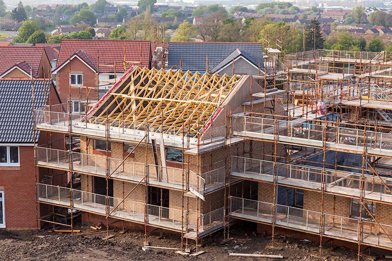
Services
Site Surveys
1. Site Planning and Surveying: Drones equipped with high-resolution cameras can capture detailed images of the entire site, providing valuable information for site planning and surveying. This includes getting an overview of the terrain, identifying potential obstacles, and assessing the site's current condition.
2. Progress Tracking: Aerial photography allows for regular monitoring of construction progress over time. By capturing images or videos at regular intervals, project managers can track progress, identify any delays or issues, and make informed decisions to keep the project on schedule.
3. Inspections and Safety: Drones can access hard-to-reach areas of a building or construction site without putting workers at risk. Inspections can be conducted more efficiently and safely, identifying potential safety hazards, structural defects, or quality issues.
4. Marketing and Communication: High-quality aerial images and videos can be used for marketing purposes to showcase the progress of the project to stakeholders, investors, or potential clients. They provide a visually compelling way to communicate the scope and scale of the project.
5. Documentation and Record-Keeping: Aerial photography serves as a comprehensive visual record of the project from start to finish. These images can be invaluable for documentation purposes, legal disputes, or future reference, providing a detailed historical record of the construction process.
Overall, aerial photography from drones offers a cost-effective and efficient way to gather valuable data, monitor progress, ensure safety, and communicate effectively throughout the entire lifecycle of a building project.
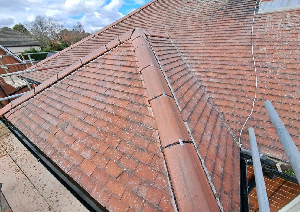
Roof Surveys
Surveying a roof with a drone offers several advantages and serves various purposes:
Safety: Roof inspection can be hazardous, especially for steep or high roofs. Drones eliminate the need for personnel to physically climb onto the roof, reducing the risk of accidents and injuries.
Access to Hard-to-Reach Areas: Drones can access areas of the roof that are difficult or unsafe for inspectors to reach manually. This includes areas such as steep pitches, overhangs, or sections obscured by vegetation.
Efficiency: Drones can quickly cover large areas and capture detailed images or videos of the entire roof. This speeds up the inspection process compared to traditional methods, saving time and labor costs.
Detailed Imagery: High-resolution cameras mounted on drones can capture detailed imagery of the roof surface, allowing you to inspect and identify issues such as cracks, leaks, missing tiles or other damage.
Early Detection of Problems: Regular drone inspections enable early detection of roof issues before they escalate into more significant problems. This proactive approach can help extend the lifespan of the roof and minimize repair costs.
Monitoring Changes Over Time: By conducting periodic drone surveys, property owners or facility managers can monitor changes in the roof's condition over time. This allows for timely maintenance or repair interventions as needed.
Overall, surveying a roof with a drone offers a safe, efficient, and cost-effective method for assessing its condition, identifying issues, and maintaining the integrity of the structure.>br>
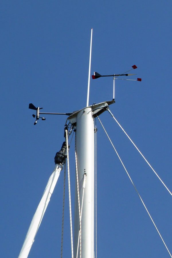
Mast Surveys
Surveying a boat's mast with a drone offers several advantages :
Safety: Climbing a mast to inspect it can be risky, especially on larger vessels or in adverse weather conditions. Using a drone eliminates the need for personnel to ascend the mast, reducing the risk of accidents and injuries.
Access to Height: Drones can fly to the top of the mast, providing access to areas that are difficult or unsafe for inspectors to reach manually. This includes inspecting the rigging, lights, antennas, and other components at the masthead.
Efficiency: Drones can quickly capture high-resolution images or videos of the entire mast, rigging, and surrounding areas. This speeds up the inspection process compared to traditional methods, saving time and labor costs.
Detailed Inspection: High-quality cameras mounted on drones can capture detailed imagery of the mast and rigging, allowing inspectors to identify issues such as corrosion, wear and tear, loose fasteners, or damaged components with precision.
Documentation: Aerial imagery obtained from drone surveys provides a comprehensive visual record of the mast's condition. This documentation can be valuable for insurance claims, maintenance planning, or resale purposes.
Early Detection of Problems: Regular drone inspections enable early detection of mast and rigging issues before they escalate into more significant problems. This proactive approach can help prevent accidents at sea and minimize repair costs.
Monitoring Changes Over Time: By conducting periodic drone surveys, boat owners or captains can monitor changes in the mast's condition over time. This allows for timely maintenance or repair interventions as needed, ensuring the safety and seaworthiness of the vessel.
Overall, surveying a boat's mast with a drone offers a safe, efficient, and cost-effective method for assessing its condition, identifying issues, and ensuring the safety and reliability of the vessel.

Just ask!
If you have a requirment for aerial photos or video just ask and we can discuss what we can do for you.